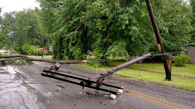
Millions of Americans embarked on the July Fourth weekend amid a backdrop of smoky haze, scorching temperatures, and the aftermath of relentless derecho winds.
The Midwest and mid-Atlantic states are experiencing another smoky day on Friday, but relief from the smoke is on the horizon. Powerful storms are sweeping across the country, effectively dispersing the smoke, but also causing power outages.
In Denver, a storm brought several inches of hail that accumulated in yards and streets, some as large as pingpong balls. Downtown Denver has also witnessed heavy rainfall, leading to flash floods that transformed the streets into a whitewater rafting course.
This weather system, known as a derecho or bow echo due to its bow-and-arrow-like shape, is making its way through Missouri and Iowa and has generated strong straight-line winds. The derecho winds struck parts of Illinois and Indiana with winds reaching 90 miles per hour, leaving around 330,000 customers without electricity, predominantly in those two states. The silver lining, however, is that as the storm moved eastward, it successfully cleared the smoke from the Midwestern cities.
SEE MORE: Fireworks warning: They caused 11 deaths, 10,200 injuries in 2022
Across sections of the Great Lakes and mid-Atlantic states, tens of millions of Americans woke up to yet another smoky morning. Air quality alerts with red and orange levels have been issued throughout the region. Notably, Washington, D.C.; New York; Detroit; and Chicago currently rank among the top 10 cities with the worst air quality worldwide. Canadian smoke is responsible for these air quality alerts in over a dozen states.
On the National Weather Service satellite image, the remnants of the system that caused the bow echo are still visible. As it continues to move eastward, it is pushing the smoke away from the Midwest but directing it toward the nation's capital and the Philadelphia area. Furthermore, this system is expected to generate more powerful storms spanning from the Rockies to the Deep South, with severe weather alerts concentrated in the affected regions.
While storms and haze continue to blanket skies, the heat dome remains entrenched in the lower Mississippi River Valley. Approximately 81 million Americans are under heat alerts, with temperatures ranging from 116 to 118 degrees Fahrenheit between Memphis and New Orleans. In the Western regions, the heat dome will intensify on Saturday, with temperatures nearing 118 degrees Fahrenheit near Las Vegas and potentially exceeding 105 degrees in Fresno, California, over the weekend.
What can we expect for the Fourth of July weekend? On Friday, storms will travel from Colorado through the Deep South, with a chance of rain on Saturday. The focus of the storms will shift to the South and the Great Smoky Mountains, with the most severe conditions anticipated in the lower Ohio River Valley. On Sunday, the storms will progress through the Ohio River Valley and into the Mid-Atlantic States.
Trending stories at Scrippsnews.com


