



One more warm day before we get weather whiplash this weekend!
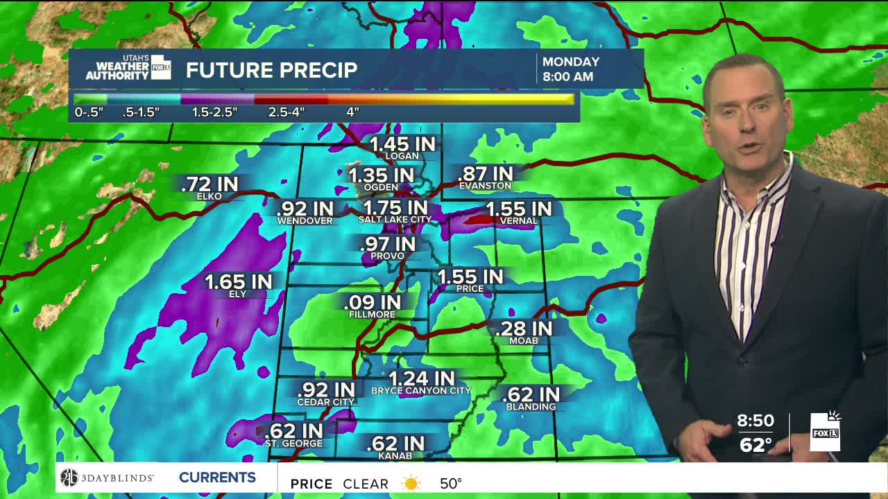
A storm will drop down the coast into California by Sunday. A SW flow developing out ahead of it will help pull remnants of what is now Tropical Storm Rachel into the Interior West as early as Saturday. With deep moisture in place, widespread moderate to heavy rain is expected, which will lead to an increased threat of flash flooding. The heaviest rain will likely be Sunday into Monday morning with strong wind gusts possible as well.
We could get a bit of a break on Monday, but it won't last long. Scattered showers & t-storms will linger through the middle of next week. Rain totals by then could be 1-3 inches, possibly even higher in stronger t-storms and over the higher terrain.
Besides keeping an umbrella handy, you'll need to grab a jacket! A cold front will knock temperatures down about 25 degrees lower than what we're expecting today. Mountain snow could even fall as low as 8,500 feet by early next week.
SALT LAKE CITY
Friday: Becoming partly cloudy. Highs: Mid 80s.
Friday Night: Becoming mostly cloudy with a slight chance of showers late in the evening. Lows: Lower 60s.
ST. GEORGE
Friday: Sunny. Highs: Low 90s.
Friday Night: Mostly clear. Lows: Upper 60s.