
SALT LAKE CITY — The bitter cold temperatures felt around Utah over the last few days will take a break Tuesday, but a new storm is expected to arrive Wednesday with extremely low temperatures and snow falling in some areas.
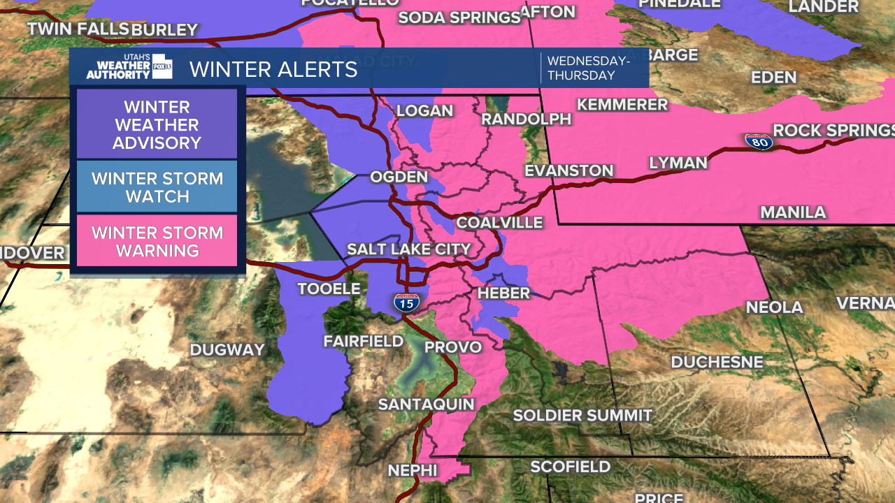
A Winter Storm Warning has been issued for the Wasatch Mountains, ranging from Box Elder County to Juab County, and in the western Uinta Mountains. Up to a foot of snow is possible for the higher mountain elevations with the new storm, with just traces of snowfall for the valleys.
Other areas of northern Utah, southwestern Wyoming and southeastern Idaho will be under less-extreme Winter Weather Advisories.
The National Weather Service also warns of "dangerous" cold temperatures overnight from Wednesday night through Thursday morning in some areas (highlighted in blue below). Wind chill could reach as low as 35 degrees BELOW zero during this time. The NWS also issued official Wind Chill Warnings for the affected areas: Box Elder County, Bear Lake area, Wasatch Back, Uinta Mountains and Uinta Basin.

Air quality is forecast to improve in northern Utah as the storm sweeps out most of the inversion that caused a haze to sit over the region Sunday and Monday.
Another weak storm is forecast to come through the northern part of the state on Friday before things clear up for the Christmas weekend.
