

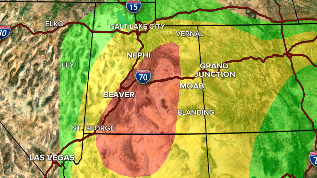


Nearly all of central and southern Utah is under a Flood Watch advisory as another round of showers and thunderstorms moves in across the state.
Storm chances will increase this afternoon and evening as monsoonal moisture combines with low pressure moving north from Arizona. Storms will be capable of producing heavy rainfall, gusty winds, and localized flooding, with the greatest concern across central and southern Utah.
In addition to the flood watches in effect for over half the state, a Flash Flood Warning has been issued for Garfield and Kane counties until 5 p.m., as well as a similar warning for Springdale, including Zion National Park, until 2:15 p.m. Emery and Wayne counties are under a Flash Flood Warning until 2:45 p.m.
Through Monday morning, flash flooding has already been seen in Zion, along with Capitol Reef National Park, Escalante, and once again in Goblin Valley State Park.
According to the National Weather Service, radar shows thunderstorms advancing into the region, where flash flooding is already ongoing or expected to begin shortly. The locations impacted by the advisories include areas where recent burn scars from the Cottonwood, Widemouth 2, Forsyth and other wildfires are located.
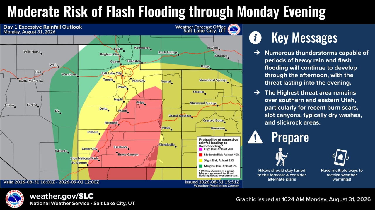
The rain may bring "life-threatening flash flooding of slot canyons, normally dry washes, streams, creeks, and rivers," according to the NWS.
While the highest potential for excessive rainfall is centered over south-central Utah, storms and locally heavy rain remain possible statewide; even northern Utah and the West Desert could see some activity.
Monday's storms come after an active and unusually wet weekend, with several locations picking up more than an inch of rain. Some areas also experienced damaging winds, hail, mudslides and flooding.
After a remarkably wet stretch to finish August, Utah is wrapping up meteorological summer much wetter than normal in many locations.
SALT LAKE CITY
Monday: Sunny in the morning, then becoming cloudy with a 40% chance of showers & t-storms in the afternoon & evening. Highs: Mid 80s.
Monday Night: Becoming partly cloudy with decreasing showers & t-storms. Lows: Near 60.
ST. GEORGE
Monday: Partly cloudy & cooler with a few showers possible in the morning, then cloudy with showers & t-storms likely in the afternoon. Highs: Upper 80s.
Monday Night: Becoming partly cloudy with showers & t-storms decreasing overnight. Lows: Mid 60s.