



SALT LAKE CITY (KSTU) — We're coming off a beautiful weekend and luckily we'll hang onto mild temps for another couple days!
The bump in the road is that moisture from a weak storm brushing by the Four Corners tonight will allow isolated showers & t-storms to pop up, mainly over the higher terrain of Central & Southern Utah.
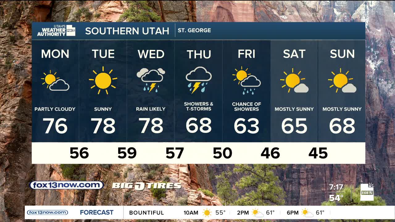
Isolated mountain showers & t-storms are possible again Tuesday, but more widespread precipitation is expected across the south by Wednesday as moisture moves in ahead of an approaching storm.
The storm will slide across the area on Thursday and Friday, bringing widespread rainfall, which could be heavy at times. .5 to 1.5 inches are possible in the valleys with higher amounts over the mountains and in Eastern Utah.
It's going to get a lot colder on the tail end of the storm Friday. Valley temps could be about 20 degrees lower than what we're expecting this afternoon. Snow levels in Northern Utah could drop down to about 6,500 ft. It looks like 3-6 inches of snow are possible, mainly above 9,000 ft.
SALT LAKE CITY
Monday: Partly cloudy. Highs: Low 70s.
Monday Night: Partly cloudy. Lows: Lower 50s.
ST. GEORGE
Monday: Partly cloudy with a 10% chance of showers & t-storms, mainly in the afternoon. Highs: Mid 70s.
Monday Night: Partly cloudy. Lows: Upper 50s.