

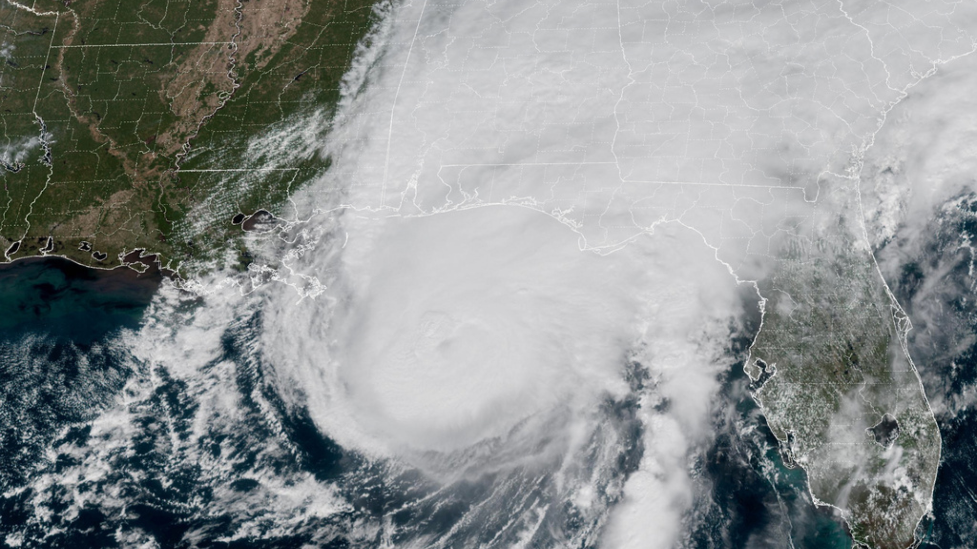


Hurricane Isaias arrived on land Friday evening around 8:35 p.m. Central Time, lashing parts of Florida, Alabama and Mississippi with heavy rains and winds up to 105mph.
The storm came ashore in Florida's western Panhandle region, near Destin, and continued moving north.
By early Saturday morning, it became a post-tropical cyclone over Alabama. It was still dumping heavy rain and kicking up gusty winds over much of the South.
It is expected to continue weakening as it moved further over land.
Government forecasters discontinued all tropical storm and hurricane warnings by 4 a.m CT. There are numerous flooding and wind advisories for the region.
Isaias marked the first time in more than two years a hurricane made a direct strike on the United States.
Nearly 800,000 customers were without power Saturday morning.
Complicated forecast
An El Niño pattern has largely suppressed hurricane development this season, as strong upper-level winds have produced unfavorable wind shear across much of the tropical Atlantic.
Isaias was able to develop during a narrow window of favorable conditions, taking advantage of warm ocean temperatures, high humidity and relatively low wind shear.
RELATED STORY | Forecast calls for below-normal Atlantic hurricane season amid El Niño conditions
Marshall Shepherd, a meteorologist at the University of Georgia, says that warm ocean waters can help hurricanes fend off fierce wind shear that typically rips storms apart.
"I am never comfortable when we have storms in the Gulf and they're intensifying even though there's an unfavorable shear environment," he said. "These storms can outperform when there's really warm water, and there's plenty of that in the Gulf."
However, as the storm approached the coast late Friday, the same wind shear that has limited tropical development this season began to weaken it. The National Hurricane Center said the timing of that wind shear would play a major role in determining whether Isaias lost strength before landfall.
Although Isaias is expected to weaken to a tropical depression by late Saturday, its remnants could bring heavy rainfall to parts of the Ohio and Tennessee valleys. Flood watches are in effect for areas as far north as Nashville, Tennessee, and Memphis, Tennessee.
Alabama Gov. Kay Ivey encouraged tourists in the Mobile Bay area to evacuate and urged residents across the state to prepare.
RELATED STORY | Study: Super-sized El Niño could cause more than 450,000 heat deaths by February
“We're worried about strong winds, heavy rain and possible spin-off tornadoes in certain parts of the state,” Ivey said. “As we approach the weekend and any travel plans, make sure you have reliable information as conditions develop. We often hear in emergency management, ‘Hope for the best, prepare for the worst.’ That is the approach we need with this particular storm system.”
Alabama-Georgia game to be played despite hurricane
One of the biggest college football games of the season is still scheduled for Saturday night, when No. 6 Alabama hosts No. 2 Georgia.
President Donald Trump had planned to attend, but opted not to due to the storm.
ESPN's “College GameDay” announced it will move its broadcast indoors to Coleman Coliseum, Alabama's basketball arena.
While rain and strong winds could affect Tuscaloosa on Saturday morning, conditions are expected to improve by the evening.
Rain and wind may have a greater impact farther north, where Vanderbilt is set to host No. 9 Ole Miss and Kentucky is scheduled to face No. 10 LSU on Saturday.
