



BEAVER COUNTY, Utah — With the devastating floods that have hit Beaver and the surrounding area, some FOX 13 News viewers have wondered:
- Is FEMA involved in Beaver?
- Is the area considered a flood zone?
The Beaver County Commission declared a state of emergency Tuesday morning, the first step toward freeing up aid at the state and federal levels following flooding in Beaver.
The Federal Emergency Management Agency is not currently involved, but that could change as the emergency declaration moves through the process.
A significant portion of Beaver sits within a FEMA-designated flood zone. According to a FEMA flood map drawn in 1977, much of the city falls within Zone A — a designation that means the area is flood-prone. FEMA assigns Zone A properties a 1% chance of flooding each year, and a 25% chance of flooding over the course of a 30-year mortgage.
The flood maps are used to guide insurance decisions.
WATCH: Beaver residents recall terror of rising floodwaters that damaged neighborhood
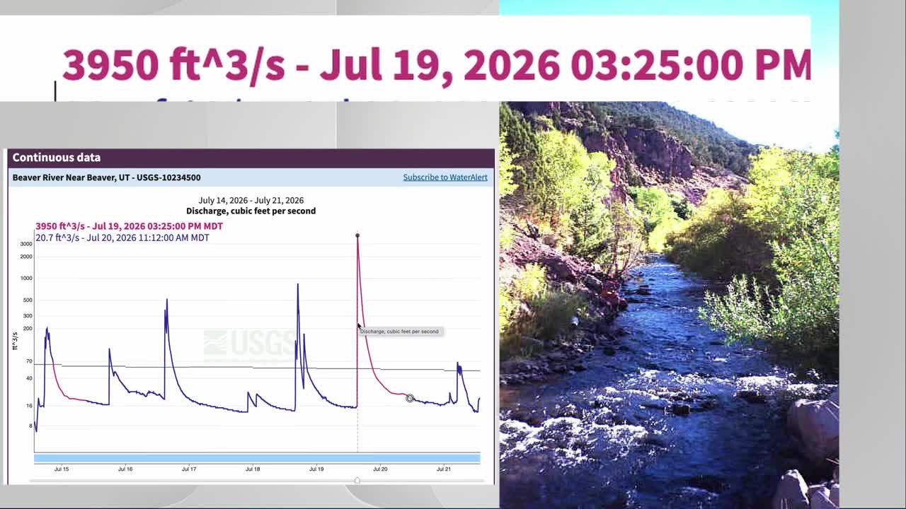
Data from a river monitoring station shows just how quickly conditions changed over the weekend. At 3:10 p.m. on Sunday, the Beaver River was flowing at just 15.6 cubic feet per second — a small creek. For context, the Jordan River in this drought year has been carrying 10 times more water, about 160 cubic feet per second.
By 3:25 p.m. — just 15 minutes later — 3,950 cubic feet of water were passing the monitoring station every second.
To put that in perspective, the Colorado River below its confluence with the Green River was flowing at 3,600 cubic feet per second at that same moment — substantially less than the Beaver River, despite being dramatically wider and deeper.
The sudden surge meant the narrow Beaver riverbed was overwhelmed almost instantly, with water spreading far beyond its banks.